|
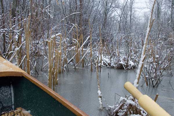
4-15: I ended up going to Saratoga, I put in at the boat launch by the 9P bridge. There was an impassable sheet of ice about one inch thick that blocked access to the lake. Funny, the launch is completely open, the lake is completely open, but there was that sheet of ice tight to both shores just at the mouth of Fish Creek.
 So I rowed Fish Creek the other way, north 2.5 miles to the rte 67 bridge, under which I had my lunch out of the blizzard, and back. It's a nice stretch, no buildings whatsoever on the northern end except for the Skidmore boat storage garage. So I rowed Fish Creek the other way, north 2.5 miles to the rte 67 bridge, under which I had my lunch out of the blizzard, and back. It's a nice stretch, no buildings whatsoever on the northern end except for the Skidmore boat storage garage.
Bailing was taken care of with a sponge. The gore-tex suit performed admirably. Saw and heard loons!
Back to Rowing Ed's Homepage
|
|
|
 |
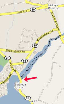
April 21: Circumnavigated Saratoga Lake, rowed 12 miles. The water level was 3 to 4 feet higher than normal so put-in was interesting.
The guy taking the money for parking ($6.) said that I should look first and find out if I dare go out with the water so high (and then come back and pay). The water was up to the backs of the benches. It was a good thing really because it kept a lot of motor boats from launching and it was fun to look at the cabins around the lake and see which of them were flooded.
The put-in was no problem because I was wearing a goretex drysuit. I just strolled into the water perfectly dry until I could step into the boat.
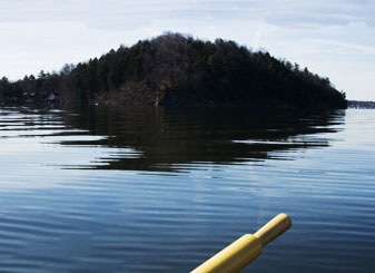
I made for Snake Hill because it the easiest point of reference on the lake and because we always use it for orientation in the winter. Oh yah, I can do this trip in my other boat (DN iceboat) in about 20 minutes. Quite a bit of graffitti on the sides of Snake Hill.
It was a beautiful flat water rowing day. I'm so glad and surprised to see so many loons on Saratoga!
Went by Brown's Beach and South Shore Marina looking for a cup of coffee, no luck so I headed for Manning's Cove where I could pull up at Karl's frontage and have lunch. His deck was about a foot under water but I could sit on the steps.
Then I went on north along the west side of the lake. You come to the Sailing Club, end of the road going north from Mannings Cove, and after that it's all marshy and not built in. Went by the mouth of the Kayderossas and tried to picture where the Kadeross park used to be. It's a very nice place now, but full of condos, totally private.
There used to be a put-in there at the park where you could launch a little sailboat, but no more. As a matter of fact you can't really trail sail on Saratoga at all.
As you can see from the map the public launch is on the other side of a low bridge, so if you have a mast on your boat you're out of luck. This is a peeve for me because it also means no launch for iceboats in the winter either. The marinas close in the winter so no access for iceboats at all.
I did quite enjoy my row around Saratoga Lake. But it's a Lake, and can't compare with the Hudson. |
|
|
Back to Rowing Ed's Homepage |
|
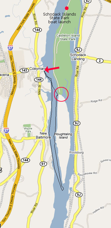
April 29: Put in at Coeyman's landing, rowed down to the end of Houghtaling Island and back. Seven miles, but the current was going out at almost two miles an hour, and a north wind picked up, so it was a good workout getting back.
I thought that there may be a channel between the bottom of lower Schodack Island and the top of Houghtaling Island. Looks like it, there's a good start of a channel there. Today the tide was low so I walked in to see. No dice, the channel looks promising at first but would require a lot of chainsaw work to cut the fallen trees, etc. And then it sort of peters out, doesn't go through to the other side.
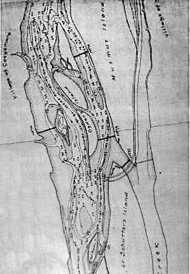
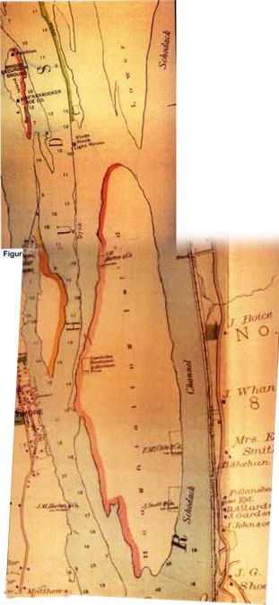
There used to be a bunch of islands here, Upper Schodack Island, Lower Schodack Island and Houghtaling Island, and several smaller ones. The Mahican Indians had a headquarters here, in 1609 Henry Hudson stopped to talk to them, the Shakers had property here. At one time there were 13 ice harvesting businesses located on the islands. It was good farm land, there's a lot of history, but beginning in the 20s the islands were covered up with debris from dredging, up to six feet thick in some places. Islands were joined or removed, the channel was deepened, and the shoreline became what we see today.
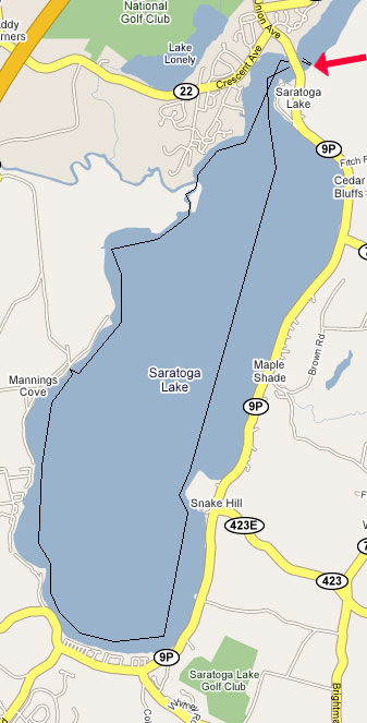
As you can see from the map, Upper and Lower Schodack Islands are shown with the name of "Castleton Island." The State Park there is not named Castleton Island State Park, but rather Schodack Islands State Park -- the better name in my opinion. |
|
 |
|
 |
|